Category: Vessel/Laboratory Page 86 of 89

Solomon Seas with MoorSPICE

                After a few days in Noumea, New Caledonia, the crew of the Thompson and the MoorSPICE scientists put our stern to the island and set course for the Solomon Sea.  It was hard to leave another tropical paradise, but we found solace in the fact that we’d be seeing more tropical paradises, albeit from a distance, throughout this cruise. 

                On our way out we saw sharks, sea snakes, and flying fish playing in the wake of our ship as we navigated our way through the 10 mile wide barrier reef.  Once we go to the edge of the reef we saw some pretty impressive Pacific Ocean waves crashing and some equally impressive wind surfers zooming over them.  It was quite strange seeing surfers out 10 miles from shore.

                The next few days we spent transiting to the first station.  The marine techs spent this time teaching the scientists how to be safe during deck operations, what to do during a CTD deployment and how to use some data processing equipment.  In turn, the scientists each taught us a little about their scientific missions during this cruise.  We had New Caledonian Biologists on board tracking the Nitrogen content in the water column, we had the LADCP ladies tracking the ocean currents and we had a mixture of French, Papua New Guinean, and Fijian physical oceanographers measuring the temperature, salinity and oxygen content in the water.  Thankfully for me, everybody spoke very clear English, but the trip certainly inspired me to start learning other languages. 

                The MoorSPICE cruise was similar to the Wave Chasers in that they both study physical oceanography of the southern Pacific Ocean with CTD casts and moorings; however this cruise was unique in several ways.  The most noticeable change was that the mooring’s buoys and instruments are smellier.  This was because they were in shallow water where there is a lot of biological activity.  The mooring lines had brought up a lot of jellyfish tentacles and barnacles when we recovered them.  My fellow marine tech, Tina, was even stung by one of these tentacles!

                Another unique aspect to this cruise is the narrow straits that we’re surveying.  We’re weaving the ship between almost all of the Solomon Islands and the currents and waves can get treacherous where the islands create a wind/current tunnel.  These currents can be up to 5-7 knots!  (If you need a reference, the top speed of the ship is ~12 knots).

                These straits are also heavily trafficked by cargo ships and fishing boats, so the mates driving the ship had a difficult time keeping the ship where it needed to be while avoiding other ships that were either heading towards us or the moorings we were working with (which sometimes laid out several kilometers behind the ship). 

                The heavy traffic and strong currents are the key suspects in the curious case of the missing mooring pieces.  While we were in the Vitiaz Strait, which had 7 knot currents, we had quite a problem with retrieving the moorings that were purposely well below the sea surface.  We put a transducer over the side and ‘pinged’ the mooring’s anchor releases.  This mooring had two releases, which are devices that wait to hear the ‘ping’ from the ship and then release the positively buoyant mooring from its anchor which sends it floating to the surface, and as far as we knew neither of them were working. 

                We tried for hours trying to triangulate the mooring’s position and get the releases to release.  However, we saw nothing at the surface.  A fear set in that the mooring had released and was floating downstream and out of sight.  This was a real possibility, because it was raining and very cloudy so our visibility was extremely low.

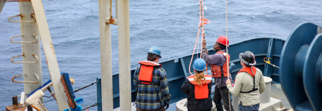
                Then, lo’ and behold, someone spots a float in their binoculars!  We all breathe a sigh of relief and the ship slowly heads in that direction.  We set up the back deck to retrieve the mooring and got the small boat ready to get in the water to hook a line into it (because the seas were too rough to hook it from the ship). 

                The visibility was so poor that it took until it was about 100 feet away until we realized that it was just a big piece of Styrofoam trash.  So since we were all standing there at the ready and being good stewards of the ocean, we dipped a net in the water and picked up this giant piece of trash.  That makes it one point for the environment, and zero points for physical oceanography. 

                 Afterwards, we eventually got the mooring releases to work and the recovery happened as planned.  However, the top portion of the mooring was missing!  There was a clean cut through a Kevlar line (you know, the stuff they make bullet proof vests out of), and our worst fear was partially realized, the top half of the mooring had washed away in the incredible currents of the Vitiaz Strait.  It took with it most of the data that it’s been collecting for the past year and a half.  This was the case for two of the moorings in the Vitiaz strait, but thankfully the third one was fully intact. 

                As I mentioned before, the cruise track had us going very close to islands in the Solomon Sea.  Some of these islands had a great deal of interesting history.  Everybody knows about the fight between Japan and the USA for Guadalcanal, and we were in the very waters where the naval battles took place right off the shore of the island!  We also went through the waters where John F. Kennedy’s ship sunk, when he was a soldier in World War II, and he swam to shore carrying an injured soldier with him. 

                There was no evidence of the war history apparent from the ocean, though.  The only indication of human life we saw was a few beachfront bungalow communities and some locals on canoes.  At nighttime we it was a light show with the huge bonfires on the shores of some of these islands and the fantastic lightning from the stormy straits. 

                Seeing land almost every day was an incredibly weird experience for me.  Waking up and walking outside, I usually expect only to see the infinite blue of the ocean and the sky.  However, on this cruise I was surprised all the time by majestic sea cliffs, rolling forested hills, giant cone volcanoes that ascend into the clouds, and even some coral reefs!  It was a wonderful change of pace from the usual endless seascape. 

               What’s more is that we saw sea life!  The deep blue water of the Pacific is barren compared to the turbulent, nutrient-rich waters of the coastlines.  We saw pilot whales, the frequent flocks of flying fish (one even landed on the deck), shark, squid, sun fish, blue runners (the one fish we actually caught!), the biggest schools of tuna I’d ever seen, and loads of dolphins that even jumped out of the water as high as 10 feet (up to the deck level)!

               All together it was a fantastic cruise that went like clockwork.  We had no major problems and the scientists got all of the data they needed.  I am now at the point where I have enough experience to run a vanilla cruise where we just do CTD’s and/or moorings and only some basic troubleshooting.  Hopefully my next cruise on the Kilo Moana will give me experience in another field of oceanography, because I’m still a padawan learner when it comes to being a full-time marine technician.

Transit to New Caledonia

                So we arrived in Apia, Samoa on February 18th with every piece of the Wave Chasers’ science equipment packed neatly in two large shipping containers ready to be lifted by a crane and carried to shore.  The amount of equipment in these containers was substantial, because all of the floats and buoys and sensors and kilometers of wire that were used on the moorings had to be sent back to the states.  This required one of the biggest cranes on the island which arrived in the morning to lift our containers off the deck, and thanks to organization and preparedness of Matt Alford and his team we should have been able to go snorkeling by the afternoon. 

                Well, not everything goes to plan while the ship is at sea, and the same applies to when the ship is docked.  The neatly packed containers full of mooring equipment must have been too much for the crane on the dock.  As it went to lift it off of the ship, the crane’s boom bent ~30 degrees due to the heavy load.  We broke it.  So now there was nothing to lift our containers to shore! 

                We ended up spending the rest of the day unpacking the containers and carrying everything across the gangway and placing it on the dock, piece by piece.  No snorkeling happened this day.  However, it was cloudy and I enjoyed my last chance to work with the Wave Chasers before we parted ways. 

                That night I said goodbye to my supervisors Brandi and Jason who were leaving the next morning.  I also got to know my new supervisors a little bit more.  Patrick A’Hearn replaced Brandi as the lead marine tech and is also from the University of Washington in Seattle.  He knows an awful lot about marine science and is very familiar with this ship.  Tina Thomas replaced Jason as the second marine tech. She had worked as the marine tech at Duke University for the R/V Cape Hatteras until it was discontinued a few years ago which is when they put her in the marine tech pool (which means she gets to go on any UNOLS ship that is looking for an extra marine tech).  Between the two of them, they have a great deal of experience and I am excited to see how much I can learn from them!

                The next day was quite eventful.  Before I said my farewells to the science team, we had a very special visitor come to tour our ship.  A caravan of police cars fancy SUVs drove onto the dock and a number of large guards in sandals and lava-lavas escorted Tuilaepa Aiono Sailele Malielegaoi, prime minister of Samoa, over the gangway and onto the ship!  This is a man whose face appears on all of their currency and must be referred to as “his Highness” exploring our geeky way of life.  The stewards prepared a nice lunch for us and the co-PI, John Mickett, gave him a tour of the bridge, computer lab, main lab and back deck.  We ended the afternoon with presenting him some official R/V Thomas G. Thompson paraphernalia and some deep sea salt from the Samoan Passage.  The University of Washington had a banner day for outreach.

                After all the excitement, we had a handful of Glosten engineers come board to assess the condition of the ship for its upcoming midlife.  During the midlife, the ship will be in a dry dock and will undergo millions of dollars of renovations to help it last another 20 years on the water.  The engineers did everything from take suggestions from the crew to performing 3d scans of the entire engine room, bridge and all of the labs! 

                Patrick and Will (from Glosten) took me down into the depths of the ship where everything is made of rust and the breathability of the air is suspect.  It is pitch black and very hard to walk around, especially for taller guys like myself.  The reason we were there was to check out the transducers and do a 3d scan of the area.  On the bottom of the ship there is a multitude of piezoelectric acoustic transmitters and receivers; in other words: things attached to the bottom of the ship that make a pinging noise.  There is one pinger that pings at a frequency that will reflect off of little particles moving through the top 100 meters of water.  It then receives the reflection of the ping and determines how fast the current is moving via the Doppler effect; they call this the Acoustic Doppler Current Profiler (ADCP). 

               There are several other types of pingers mounted to the hull that are more useful to a geologist, such as the EM302 which basically uses sound to snap a picture of an area of seafloor below the ship.  The ‘snapshot’ shows changes in elevation and allows you to display the basic bathymetry of the seafloor in three dimensions.  Another pinger is the Knudsen CHIRP sub bottom profiler which, unlike the EM302, it shows what is going on under the surface of the seafloor. 

               All of these pingers are either hard mounted or on a retractable stem.  The retractable stem allows you to bring the device inside the ship and then drain the seawater before opening a door and being able to work on it.   During the midlife, they might be adding or fixing some retractable stems to the transducer well, but nobody is certain about anything when it comes to the midlife refit.

                So after a few days of testing and tweaking things on the winch we finally saw New Caledonia!  We had some huge swells during the end of the transit to Noumea, and a few of them rolled us more than 30 degrees!  This is enough to knock a tall guy like me off of my feet unless I’m holding onto something.  It is also enough to slide all of our papers, coffee mugs, glass beakers and laptops off of our desks, and enough to roll a mini refrigerator across the room.  The end of these big swells left broken glass on the floor, chairs toppled over, papers and books strewn everywhere and electronics broken or misplaced.  When I walked into my usually clean cabin it looked like someone had ransacked it.  This taught me a valuable lesson about rogue waves that I will not soon forget.  From then on all of my equipment has been strapped down tight or is on a rubber mat.

                Cruising into Noumea, New Caledonia in the late morning was perhaps the most picturesque thing I’ve ever seen.  First we met the pilot boat so many miles away from port that you could barely see land on the horizon!  This is because the barrier reef off the coast of Noumea is the second largest barrier reef in the world!  Seeing huge waves crash on the edge of this underwater world, while land was still a shadow in the distance, was a surreal experience.  Then we saw tiny white sand islands all throughout the reef as we approached the big island with big buildings, resorts and some smaller mountains covered in trees.  This was much more upscale than Samoa with the big hotels, but nothing like Waikiki.  It was the goldilocks of Pacific Islands that I’ve seen so far.  As we entered the lagoon where the port was we saw helicopters taking people on tours over the mountainous forests, giant cruise ships filling up with passengers and sailboats as far as the eye could see.

                Once we docked we had to wait for customs to clear our ship and passengers before we could get off.  It took them all day to check off everything on their list, including having us put up rat guards on our mooring lines.  Meanwhile we were stuck on the ship with almost nothing to do.  So the third mate and I found a project for everyone to do that was fun and killed a lot of time.  The A-Frame on the stern of the ship needed to have a line strung through one of its blocks.  In layman’s terms that means we needed to get a rope through a hole that is 30 feet off the ground.  There is a ladder that we could’ve climbed up and then used a pole to put the rope through the block, but that’d be too easy.  So we made a monkey’s fist (a big ball of a knot) on the end of a rope and made it into a contest to see who could throw the monkey’s fist through the tiny hole in the block.  Fast forward four hours and we eventually got it through, and had attracted the entire crew to give it a try! (I was the one that threw it through).

                After the customs people left, we were able to start loading the equipment for the next cruise, MoorSPICE, with Janet Sprintall.  This is a cruise with moorings and ctd’s much like the last one with Matt Alford.  However, this science team is a worldwide collaboration with 2 French Mooring guys, 2 Californian Mooring guys, 4 French scientists, 1 Fijian scientist, 1 Papua New Guinean scientist, 1 German scientist and 2 Californian scientists.  Quite an eclectic group of people and there will be some slight language barriers, but I feel as though this group will teach me an awful lot about their cultures and new science!

End of the Wave Chasers Cruise

                During the last two weeks of the Wave Chaser’s cruise in the Samoan Passage, problems grew exponentially for the marine techs.  The tow-yo troubles continue; and as we work the winch harder and harder, it shows more and more signs of exhaustion.  A bearing broke in one of the sheaves that guide the wire onto the spool as we’re pulling it up.  This caused the sheave to wiggle and resulted in a heavy metal cable with thousands of pounds of tension on it to overlap on the spool.  (The cable usually wraps in perfectly even rows to avoid uneven loads or snapping under high tension.) It also has delicate electrical wire inside of it, which can break if stretched or twisted too much.  These are all big problems, but the sheave replacement was not a marine tech problem.  The engineers handled the replacement of the bearings in this sheave and they even let me help!

                Towards the very end of the cruise, while all of our attention was focused on the reoccurring winch problems, yet another challenge presented itself.  The Internet went down and the pressure was on to fix it!  We keep an oscilloscope hooked up to the antenna which tells us if we are transmitting and receiving satellite signal.  The signal disappears whenever the ship rolls a certain way.  My marine tech advisors, Brandi and Jason, explained to me that this is usually due to the mast getting in the way of the satellite dish, which is almost directly below it.  So we waited until the next time the ship changed its heading. Once we turned, we hoped that the mast would no longer be between the satellite and our satellite dish.

No luck.

                The next day we went up into the dome!  The dome is a large, weatherproof, fiberglass container where the satellite dish lives.  It has an air conditioner to keep the electronics cool, which was nice on a hot afternoon, but it is not easy to walk around inside of it.  Once you climb up inside of it there is only a narrow pathway to walk around while having to duck to avoid hitting the gimbal mount.

                Our first plan of attack was the classic question—“Have you tried restarting it?” But once again, we had no luck. Upon further investigation and e-mailing, though, we came to the conclusion that the problem was that it was having trouble pointing towards the satellite.  (We have an extremely small spare satellite Internet dish for emergencies like this.  However, it has a very small bandwidth.)

On a ship nothing stays still, and with this satellite dish we need to point it directly at its satellite.  So, the perfectly balanced gimbal compensates for the pitch, roll, and yah movements of the ship and it also has motors to adjust where in the sky the dish is pointing as we cruise across the ocean.  So, we figured out where it needed to point and told the motors to point it in that direction; however, it couldn’t do what we told it to do.  This is indicative of a mechanical problem.  So we investigated up in the dome again. 

We turned on the gimbal motors while we were inside of the dome.  This was scary.  The satellite is very big and takes up the upper half of the dome, except now it was tilted all the way down and pointing at the horizon.  So, we were squished on the other side of the dome with nowhere to walk.  Then the satellite went into “searching mode” and started chasing us around in circles inside the dome.  It was quite the thrill.  We eventually realized that the satellite is actually above us and the dish is not pointing upward.  We concluded that the motor that turns the satellite from the horizontal position to the upright position wasn’t working.  (Think of the act of tipping over a birdbath and picking it back up.) Luckily, we did have a replacement for it onboard!  So Jason and I went up into the dome for a few hours and swapped out the motors very delicately.  Once we turned the dish back on, we check our e-mails and there was much rejoicing!

The combination of the failing winch, losing an instrument, and the Internet being down is a perfect encapsulation of the uniquely challenging job of being a marine technician.  These problems could cause a panic, but it is our job keep calm and make the smartest use of the shipboard resources we have and get as much data as possible for the scientists.  Every day there is a new, difficult, and exciting project to tackle; and I couldn’t ask for a more intellectually stimulating experience!


Tow-Yo Troubles on the Thompson

We’ve hit the midway point in the Wave Chasing cruise! Up until this past week, almost everything has gone according to plan.  So, it was about time that a challenge presented itself, and what a challenge it has been!

The art of the tow-yo is simple enough to understand.  The goal is to be able to look at the ocean in two dimensions, basically a side view map of the temperature and salinity differences.  In order to get a continuous cross section of data, we must raise and lower the CTD sensors like a big yo-yo (hence the name) while the ship is moving slowly forward.  We do this for as much as 27 hours straight!  Now the challenge arises when you figure the amount of stress that puts on the winch, the scientists and the winch operator.    

The CTD is a half-ton jungle gym crawling with electronics and expensive sensors, and it hangs miles below the ship by a single cable that is not even as wide as my pinky.  It is so far away that if it were to look up at us, we would be look much higher than most skydiving planes ever go.  Not only is it really far away, it is also in a harsh dark alien world, under bone-crushing pressures and surrounded by a concoction of salts that is constantly trying to corrode and short-circuit our conductors.  It is not the easiest place to send our heavy jungle gym of expensive electronic equipment.

So, the story starts out with a seamount creeping up on us while we have the CTD close to the bottom.  It accidentally hit this seamount and may have even tumbled a little bit.  After bringing it back on board to be inspected, we found seafloor sediment and a few broken sensors.  Then we discovered some kinks in the wire and had to cut off about 250 meters of this 10,000 meter cable. It took six hours until the sensors were replaced and the cable was ready to go back in the water, but that wasn’t the end of our problems. 

After we fixed everything that looked wrong with it, we put it back in the water and sent it back down to five kilometers under the sea surface.  But it only made it to ~3 kilometers before something short-circuited and shut off some of the equipment. Then we had to bring it back up for more repairs!  

This time it was evident to my supervisors that the problem was that there was water getting into the wire somewhere and the most likely place is a soldered connection between the 10km wire and rest of the electronics on the CTD. 

In order to fix this new problem we had to redo the waterproof splicing which we did using the hot glue method.  This proved to be successful and we had 14 blissful error-free hours of CTDing, but then the real trouble started!

In the middle of the night, the display that shows the pounds of tension on the cable started skyrocketing!  We immediately panicked, because the only reason that the tension would have spiked is if we had snagged something on the bottom of the ocean. Straightaway, all chiefs, techs and captain reported to the bridge to discuss what to do next.  The tension normally never goes over 4,000 lbs. and the breaking point on the cable is ~10,000 lbs.  At the time it was showing ~9,000 lbs.!  We stopped the ship instantly, because if cable breaks the CTD plummets to the bottom and we lose all of our instruments then we pretty much have to pack up and go home! In the dark of the early morning, from the bridge we all watch in horror as the display jumps up to 12,000lbs.! Our hearts dropped out of our chests as we strained to see whether or not the cable was still there. 

Thankfully, the cable remained attached to the ship, and as far as we could tell so did the CTD, but how? It turns out that the problem was an electrical problem with the sensor on the winch that measures the tension, the tensiometer.  When we went take apart the electrical components of the tensiometer we found that a junction box of electrical wires was half-full of rain water! Uh oh!

It took me an entire day to go through each and every exposed connection and take off the corrosion that had built up.  Afterwards, we recalibrated the tension and it was back to normal.  Everybody breathed a sigh of relief. 

This was by no means the end of our trouble with the Tow-Yo and the winch, but it is the closest to a happy ending we’ve had with it.  I continue to learn an awful lot about how technology and the ocean do not mix easily, but it’s my job to make it work and keep it working!  I am extremely comfortable with my job security as the Marine Techs are working around the clock desperately trying to fix the wealth of challenges that the ship has to offer.  Also, having things break and getting to put them back together is a fantastic way to learn the nitty gritty details of the equipment I’m working with on the ship.  (Just don’t let the scientists know I said that)

Gray Skies and Blue Marlin

So the days are already starting to blur together.  It’s so spooky how much time flies on the ship after settling into a routine.  However, my shipmates are very good at making sure the routine does not get monotonous.  The cooks have set up an inflatable pool on the bow and cooked us a fantastic barbeque of grilled vegetables, chicken, and lamb-ka-bobs.  We lounged around and had a great time listening to music and the endless stories of the experienced sailors and scientists.  

My favorite storyteller is Todd who is a very experienced at his job and with fishing. He is teaching me how to catch fresh fish for the next barbeque.  Sometimes, when there is no science going on and the ship is just cruising to the next station, we throw out as many as nine hand-lines which drag behind the ship.  Previous attempts on this cruise have been unsuccessful, until just the other day when we had a giant stroke of luck.  I saw Todd leaping with excitement and ran over to help him pull in his catch.  Eventually it took three people to pull in the seven foot Blue Marlin!  The lowest deck on the ship stands 11 feet off the water, so it would have been a real workout to pull it up.  However, after the entire population of the Thompson converged on deck to see it up close we had to let it go on the terms of it being a game fish.  It made for quite an exciting day!

Besides eating outside in the fresh salty air and deep sea fishing, we also have movie nights, play card games, gamble on the Super Bowl (I’m on a ship from Seattle), and my favorite thing to do is sit and watch the sunrise.  We have a beautiful pink, orange and blue sunrise every day that burns away all of the big puffy cumulus clouds that cover most of the sky in the morning. It really makes for a cool and majestic wake-up routine before the brutal mid-day sun starts burning the ship.

The ship and all of the science equipment onboard, also do a great job of keeping the monotony from settling in with their persistent challenges and utter complexity.  There is always something that is acting ‘wonky’, and needs attention from a marine tech.  One particular problem was that the gravimeter was giving bad data.  The gravimeter is a very sensitive and practically priceless science commodity simply because they don’t make them for ships anymore.  They measure minute changes in gravity and they are so precise that even the rocking of the ship skews their measurements.  So there is a double gimbal system in which it sits to keep it perfectly level.  That gimbal relies on a gyroscope that measures the roll of the ship and another one that measures the pitch.  The pitch gyroscope was not working, so we had to replace it.  I’ve never felt more like a surgeon than when I was taking this delicate instrument apart and switching out an old sensor for a new one.  It required lots of patience and care, but I was able to take it apart and put it back together successfully.  It’s really awesome the amount of amazing equipment is onboard and that they trust me to tinker with it!

Every day I’m becoming more confident in my abilities to solve scientist’s problems out at sea!  I am very grateful to have such a classy and intelligent group of people on my first cruise as an intern!  

Let the Wave Chasing Commence!

So after cruising for a couple of days, we are now in the study area where we will be spending the next five weeks.  If you have read my previous blog then you know that I was seasick for the first day.  Well, thankfully the Pacific Ocean has been living up to its name, because the water has been perfectly peaceful.  Therefore, I am able to operate on all cylinders again! Unfortunately, there is a plethora of other types of illnesses traveling around the ship now.  Nonetheless, the show must go on!

We spent the first couple of days retrieving lots of moorings that were in the ocean taking measurements for a year and half. The moorings are extremely long cables that stay vertical in the water between an anchor and a buoy.  Along the line there is an instrument that crawls up and down taking measurements of the entire water column.  Due to all of the components of this system, it is a very complex operation to get these things onboard. It usually takes two or more hours from start to finish, which can feel like a long time out under the tropical sun.

After learning what these instruments can do I started to get curious about the area that we are studying.  So I sat down with someone from the science team and got a better understanding of why we’re collecting all of these data.  He told me that the region we’re in is called the Samoan Passage and it is a very important spot for the Pacific Ocean’s thermohaline circulation. 

Ocean circulation plays a critical role in the global climate.  For example, most of Europe would be much colder if it weren’t for the Gulf Stream bringing up warm ocean water from the tropics. So understanding how ocean circulation works is imperative. There are several ways that the ocean circulates, but this study addresses the thermohaline circulation in the Southern Pacific Ocean. All of the cold water near Antarctica sinks to the bottom and starts slowly traveling back to the equator.  At one point along its journey, the Samoan Passage is the only place deep enough for the very cold and dense Antarctic Bottom Water to travel northward. So it is squeezed through this passage that is only a couple of kilometers wide in some places.  The science party is quantifying the amount of mixing that is happening in this passage.  They call themselves the ‘wave chasers’, because the cold Antarctic Bottom Water is passing over these very deep ridges which form standing waves that are seen best in our temperature profiles.  These standing waves are similar to the ripples you see over shallow rocks in a river or stream, except the amount of flow over these ridges is several times greater than that of the Amazon River.  It is truly exciting stuff, and I am sure that I will learn much more about the Samoan Passage over these next couple of weeks.

The science party would be hard pressed to get the data they needed without the crew and, of course, the marine techs. This week I learned quite a few new things from both of them.  The crew taught me how to hand-line fish off the back of the ship after seeing tuna and marlin one morning.  Thus far, we have been unsuccessful in getting any fish onboard the ship.  As for my main job, I learned a very valuable skill for a marine tech: how to splice a wire and make it waterproof.  Normally, I just twist two exposed electrical wires together, maybe put some electrical tape on it and call it a day.  However, we had some problems with our CTD and had to splice a wire that we are sending 5000 meters under the sea.  This poses quite a challenge.  Even so, we were successful in our waterproof splicing.  We used a newer method that consisted of crimping, soldering, hot gluing, heat shrink tubing and then electrical tape.  I never thought I’d be using hot glue and a blow dryer (for the heat shrink tube) for electrical work. 

So now that I have spent about a week developing my marine tech skills and have good understanding of the science, I feel like I’m becoming a viable member of the ship!  I still have a very long way to go until I get to the level of competence that my supervisors Jason and Brandi have, but I am confident that I can get there! 

Gearing up for 40 days with the WaveChasers

So it took me just under 30 hours to travel 10,715 miles to the Faleolo airport in Samoa, and I had good luck the entire trip!  Being a tall guy it is difficult to be comfortable on airplanes.  However, thanks to the recent winter storm a lot of people couldn’t make it to their flights so there were lots of open seats with leg room! My favorite part of the plane rides was definitely watching the sunrise over the tropical Pacific.  I also thoroughly enjoyed Air New Zealand’s “safety video” which was directed by Peter Jackson and featured characters from the Lord of the Rings. My day in the clouds couldn’t have been any better!

Once I landed the heat and humidity hit me like a train!  It was around noon and the sun had cooked the Samoan air to a balmy 90 degrees, and with the 95% humidity it felt like 100 degrees! The airport was only large enough to handle one plane at a time which made us passengers feel like royalty when we walked off the plane. There was a crowd of people waiting for us and soon two crew members and I were driving to the ship.

The first two things that struck me about Samoan culture is that they drive on the left side of the road and the men wear long dresses.  Once I got used to that, I looked around and noticed that most of the houses didn’t have any walls at all! Instead, they had lots of pillars and a large roof. It makes for very good ventilation, I guess.

Upon further investigation of the island I observed a large number of stray dogs. Apparently they run the place. Everyone puts their trash up on stilts so that the dogs can’t make a mess of it.

After an hour drive, we finally arrived at the ship, and it felt as though I had found an old friend. I walked onboard and recognized the famous cooks of the ship: Terrance, Sarah, and India.  Before I even got a room assigned to me Terrance, ‘Grey’ and I hopped on some bikes and rode to a beach with an amazing coral reef!  We saw a sea snake, sea turtle, crown of thorns, some bright blue starfish and even the fin of a little reef shark.  I was amazed at how much colorful biota lives under the surface!

The next few days in the Samoan port were extremely rainy and consisted of learning different computer systems that control and record the arsenal of sensors aboard the ship.  The co-chief scientist, John, asked me to help him put a custom mount for his sensors on the big steel cage that houses the CTD.  With the help of one of the Marine Techs, Jason, I was able to make it work exactly how John wanted it. After working on that, Jason and I went strolling through town and got lunch and a final haircut before leaving for a whopping total of $10!

Then we left port on Friday January 10th around dinnertime.  I had been naïve enough to not take any sea sickness medication, and the first day of transiting involved some pretty rough seas.  I was incapacitated for almost the entire day.  However, once we got to our first station the seas calmed down significantly and now I’m better than ever! Wish me continued luck with the weather for this next week!

PS. I’ve had no luck uploading pictures, but I will keep trying!


Samoa-Bound

So here I sit with my loved ones in my hometown of Reading, PA with only three days until I leave for Samoa!  I am anxious, excited and unfortunately sick. Nonetheless, I am doing everything that I can to prepare to be away from my friends and family for so long. I have never been away from them for this long, but I couldn’t imagine a better way to spend my time.  

It will be hard to leave my loved ones, but I am really really looking forward to this internship!  Samoa, here I come!

Special Thanks

As we approached the third and final week of the voyage, I was beginning to fear that the lack of fresh vegetables and lettuce as well as limited sunlight might have a permanent effect on my psyche.  I also knew that that the chances of seeing Arctic wildlife were diminishing by the day.  So I was I was filled with mixed emotions as we wrapped up the research and began our journey home. Over the course of the trip, we had completed 13 CTD transects for 183 CTD casts and, as we headed back towards Dutch Harbor, the last few days of the cruise were spent relaxing and catching up on much needed sleep. I also finally got the chance to stand on the bridge and was lucky enough to spot several whales, most likely humpbacks, three pods of porpoise and two ringed seals, one of which was eating a large crab of it’s chest. The time also gave me the chance to reflect on how lucky I was to have had the opportunity to join the scientific crew aboard the Healy. Not many people can say that they have traveled above the Arctic Circle, cruised along the International Date Line, conquered the Gumby suit, witnessed the loss of sunlight at the rate of ten minutes/day, fallen asleep to the pitch and roll of 20 foot swells or listened to the eerie sound of miles upon miles of meter thick frozen ice being broken apart or dropped a personally decorated Styrofoam cup to the depth of 3,000m and seen it return as a perfect miniature of its original self, all while learning about and assisting with important scientific research.  Now that I am back on land, I can truly say that I will miss life onboard the Healy and would jump at the chance to return for another expedition. The experience was one that I am extremely grateful for and will be difficult to forget for all the right reasons. There are so many memories that I want to hold on to—some big, such as the confidence I built up in learning to operate the CTD or seeing the Northern Lights—others, small moments such as clumsily walking into a Conex box and scarring my forehead, thus giving inspiration for a hastily put together Halloween costume as a blind mouse. I would like to thank everyone who supported me along the way, especially, Bob Pickart, Carolina Nobre, Scott Hiller and Alex Quintero for putting up with my slow learning curve of both the CTD and the science, the US Coast Guard for providing support for important research, the MATE program for providing me with the opportunity and the science team (Tanja, Lauran, Liza, and Maria) and crew (Brian, Kevin, Mo, Gianna, V-dub, and Jeremy) for keeping me honest, helping me laugh at least once a day and appreciating the simple things.  A very special salute goes to the Coasties, who do such an amazing job operating the ship—I am in awe of their discipline and efficiency. Thank You.

Some Science

Even though the Healy is a Coast Guard boat, its primary function is to provide technical and man support to Arctic scientific research. I was impressed, although not surprised, by the high number of projects that were benefitting from Healy cruise 1303. For example, from each CTD cast at least 8 different, however, related researchers were collecting important data. One of my favorite parts of the cruise were the science lectures that were given on sporadic nights throughout the trip. As someone who is just beginning a career in oceanographic research, this was an amazing opportunity to learn about different types of research that have important environmental implications.  The following are summaries of a few of the research projects aboard the boat.


Lecture 1—Breathing in: What we learn about life and death in the ocean from oxygen (Laurie Juranek—Oregon State University)

 Studying oxygen concentrations in the ocean allow researchers to track and better understand the biological and physical processes at play over a time frame as short as a few weeks to as long as several centuries.  In order to study these concentrations, Dr. Juranek establishes “water columns,” which are conceptual columns of water from surface to bottom sediments and are useful for evaluating the stratification of the thermal or chemical layers in the ocean.  Oxygen is present in these water columns as a result of both physical and biological processes; however, what primarily interests researchers is the oxygen in the water resulting from the biological process of photosynthesis because oxygen levels are indicators of phytoplankton (diatoms, coccolithophors, cyanobacteria, etc.) going through the photosynthesis and providing or becoming the bottom of the food chain and, by extension provide a picture of the overall productivity of the ecosystem. Surface water samples with high oxygen levels are an indication of higher productivity, while areas of low oxygen are an indication of low productivity.

In order to illustrate productivity in the water column, Juranek, uses known relationships between water temperature and the amount of dissolved oxygen and argon to determine the deviation of oxygen saturation from the expected equilibrium levels. The reason for looking at the relationship between oxygen and temperature is that the interactions are predictable as colder waters are able to hold higher amounts of gas. Argon is used as a comparison gas because it is an inert gas and, therefore, not impacted by biological processes, while it still acts in similar ways to oxygen in the water column. Surface water is collected during underway transport and then sampled using a mass-spectrometer to determine the weights of the gasses present in the water. Using the relationship between the argon and oxygen saturation levels, Juranek is able to determine if the direction of the oxygen flow is a result of biological or physical processes.

Based on the most recent data collected on the cruise, Juranek is finding that the highest rate of productivity is at the Chukchi shelf, while the lowest rate of productivity is in the Bering Strait, where the water is relatively unstable. These results are what she was expecting to observe; however, she is excited to continue to sample throughout the area.


Lecture 2—Nine North Slope Mooring Cruises: What have we Learned? Bob Pickart (Woods Hole Oceanographic Institute)

Prior to 2002, very little was known about the currents of the Arctic Ocean and what happens to the warm Pacific water and cool Atlantic water after entering the Bering Strait. Over the last ten years, Dr. Pickart has been gathering data about the water flow dynamics, particularly within the Pacific Water Boundary Current that runs between the northern Alaskan coast and the Beaufort Shelf and flows as far west as the Amundsen Gulf in Canada. Originally it was hypothesized that a majority of the water entering at the Bering Strait would follow the expected path along the northern coast of Alaska. However, the collected data reveals that the PWBC is “leaky,” with less than 20% of the water making it into the current. Even more striking is that this percentage has been decreasing over the last few years, while the amount of water entering the Bering Strait has increased. Based on the data, Pickart believes that the water is lost as a result of two pathways, eddies and storms.

Pickart uses both moorings, which provide continuous data collection for as long as the battery lasts (about a year), and CTD transect lines, which provide a snap-shot of the water column.  Using the moorings, which are deployed and collected yearly, Pickart has gained a much better understanding of the impacts of storms on the PWBC, but hopes to further this knowledge, particularly with respect to the impacts of the increasing shifts in wind patterns and the resulting current changes, with data collected over the last several years as well as this voyage. Traditionally, the current flows east with the “warm” Pacific water on top of the “cooler” Atlantic water. In opposition to this current, the winds blow from the east. Typically, these winds have little to no effect on the current direction; however, during major storm events that result from the Beaufort High and Aleutian Low, the increasing wind speeds have a current altering effect. Pickart has discovered that it only takes wind speeds greater than 4m/s to result in a reversal of these currents.  Not only does the current completely change directions and flow to the west, but also the cooler Atlantic water pushes to the top, resulting in what is known as an upwelling event. Additionally, the warmer waters are pushed north into the ice regions, resulting in dramatic ice melting events. Following a storm, the winds subside and the current returns to its natural state. As the climate is changing, the winds in the Arctic have become more intense, especially during the summer and winter months leading to more upwelling and ice melting events, even during non-storm periods.

To further understand the current patterns of the Atlantic and Pacific waters, data collected through CTD casts are conducted on transect lines along important oceanographic features within the PWBC that include Barrow Canyon and Hanna Shoal. The CTD casts create full profiles of the water column and enable Pickart to use the abiotic features (mainly temperature and salinity) of the water to determine the origin of the water.  Using this data, he can create maps of the water flow patterns throughout the western portion of the Sea.


Lecture 3—Ocean Acoustics, More than Just Whales (Bruce Thayre—SCRIPPS Institute of Oceanography)

Thayre is using acoustic information collected from moorings to determine the anthropogenic impacts of sound on aquatic environments in the Arctic region. Instrumentation converts sound waves into a frequency, which is then used to make a spectrogram of the sound wave as it passes a fixed point. Using these graphs, Thayre identifies the different types of sounds occurring at all times. As it turns out, the Arctic Ocean is a very noisy place, filled with sounds resulting from biological, environmental and anthropogenic sources. Some of the loudest sounds in the ocean are marine mammals, rain, the movement of ice and seismic testing. Thayre is most interested in the sounds resulting from the air guns used for seismic surveys for oil and gas development. These air gun shots can be heard from over 100km away. Understanding the impacts of these sounds is important because they are most frequent during the months of September and October, which is also peak whaling season, so there is concern from local whalers that these tests are disrupting the yearly hunt.


Lecture 4—What can we Learn from Ice Algae in the Arctic (Tanja Schollmeier; University Alaska Fairbanks)

In order to gain an understanding of the impacts of changing climate on the Arctic benthic community, Schollmeier is using fatty acid and ice biomarkers to follow the food web. Within the Arctic ecosystem there are two different types of algae, ice algae and open ocean algae. Each year ice melts and reforms; with the reformation, there is an associated ice algal bloom. As a result of the seasonal timing, these ice algae rely heavily on C13 for growth (while open ocean algae rely on C12). Using fatty acids, this C13 can then be traced up through the food chain in organisms from diatoms to benthic filter feeders such as clams, mussels and crabs. In areas where there has been higher ice coverage, there is typically a higher concentration of C13 fatty acids in the benthic community. Additionally, Schollmeier uses the ice biomarker IP25, which is a highly branched isoprenoid as it is only produced by algae that lives under the ice where light can shine through. As this is a relatively new strategy for tracing the consumption of ice algae, Schollmeier plans to quantify IP25 in samples collected in the water column, sediment and benthos. The ultimate goal of her project is to use fatty acid and IP25 analysis to determine if there are patterns of quantity along ice cover and, if so, to determine whether some organisms or specific feeding types show different patterns of algae consumption.

Page 86 of 89

Powered by WordPress & Theme by Anders Norén