On a sunny Thursday morning we set sail across the Bering Sea. The final preparations for the cruise involved tying down all science equipment and double checking inventory list for everything that we might need while out at sea. The ship was brought off the dock by a tug boat and we began our voyage towards the Arctic.
First day of a scientific cruise is one of the busiest times for a Marine Technician. There is a multitude of onboard continuous instruments that need to be started as the ship sets sail. The physical oceanography instruments include: ADCP, single-beam echosounder, multibeam echosounder, meteorological sensors, gravimeter. There is also a couple of chemical oceanography sensors, such as atmospheric pCO2 system and an underway seawater pCO2 system. My interest align much more with the physical measurements, specifically the ADCP and echosounders.
ADCP stands for Acoustic Doppler Current Profiler. The task of this instrument is to measure ocean currents while the ship is underway. While at sea, I’ve been spending my time familiarizing myself with this instrument by meticulously reading the training manuals provided by STARC as well as asking for a theoretical background from some of the scientists aboard. The two ADCP systems that are installed on the Healy are set two sound frequencies, one is set at 150 kiloHertz the other at 75 kiloHertz. THe lower the frequency allows the ADCP sensor to sample at a greater depth, while the higher frequency provides much more precise measurements of surface currents. One of the unique opportunities of studying instrumentation while at sea, is to immediately apply my knowledge to ongoing projects.While the ADCP is used for collecting ocean current, the multibeam echosounder is the instrument most people think of when talking about ocean surveying.The Multibeam Echosounder is also an acoustic instrument, but it is used for mapping the ocean floor. Colloquially known as bathymetry, or the topographic map of the ocean floor. The software on board allows for real time view of the bathymetry as the ship passes through a region. One of the responsibilities of STARC, and most marine technician in general, is to have round the clock monitoring of the system and data to guarantee accurate bathymetry data collection. Much of the work that the STARC team conducts is based in the computer lab, with many routine checks of instruments throughout the ship. Often times I feel overwhelmed by the amount of information presented to me, but so far I’ve been able to keep up with what’s going on. There are many additional challenges and problems that come up during work in such environments such as the Bering Sea.
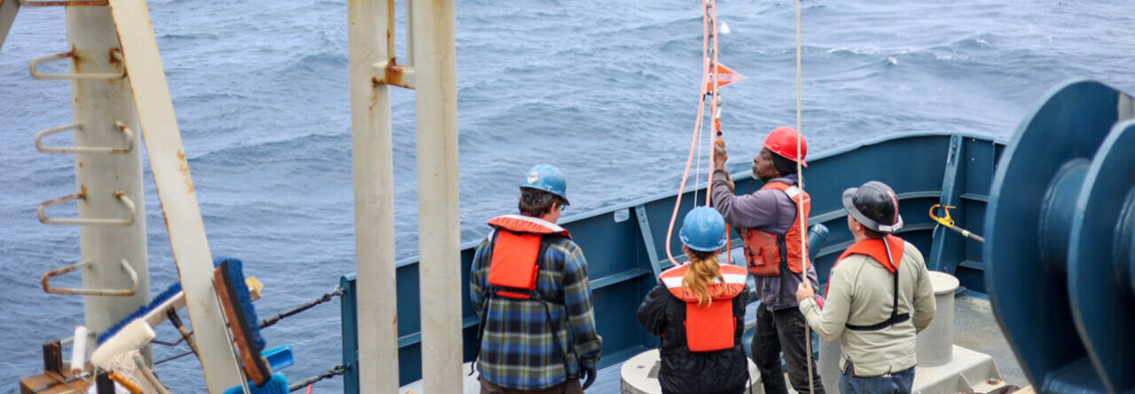
The Bering sea is exactly like I’ve read in books; cold, rainy and gloomy. Yet there is something beautiful about such a bleak place. The difficulty of the environment is highly reflected in the science operation planning. Every little detail is talked over between members of the science party, technicians and Coast Guard personnel. In addition, the STARC Coordinator is adamant on recording all ongoing projects and methods. In my eyes the database of all methods provides a business model for conduction scientific operations in this environment. I’ve sailed on a couple scientific research vessels before, but I’ve never seen such a high level of planning and coordination. The STARC team definitely takes pride in there work, with meticulous planning and record keeping of everything they do. I find myself working more than the 12 hour shift assigned to me, just to see as much as possible of the work done at sea. We are currently in transit, but in a couple of days we will arrive at our first mooring station.


