3: Across the horizon
On a clear day, we can see for miles in all directions. The swell is low, but the ship still rolls back and forth as we cruise on.
Our course is set for Hydrostation S; only a few dozen miles south of Bermuda. This site has been visited and sampled every other week since 1954, making it the longest-standing oceanographic time series in existence. The sampling at Hydrostation compliments the Bermuda Atlantic Time Series (BATS), another sampling station, even further south, which began in the eighties. Hundreds of cruises have been completed to support this endeavor. In turn, hundreds of research articles have been produced that provide fundamental understanding of issues such as oceanographic processes and global climate change.

Sunset at sea.
The BATS team is our primary client. The scientists that run this operation are based at the Bermuda Institute of Ocean Sciences (BIOS), the same research facility that the Explorer docks at. Some members of the lab have been part of the BATS team for decades and are very familiar with the ship and crew. Time aboard Explorer is incredibly pricey. Depending on the demands of the cruise, costs can run as high as a thousand USD per hour. Every second aboard the vessel is incredibly precious, and the BATS scientists know very well how to make the most of every moment.
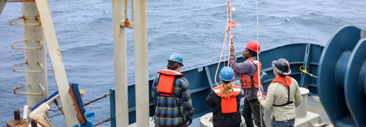
As soon as we reach Hydrostation, we prepare for our first cast. To monitor the physical and chemical properties of the water column, we use an instrument that measures Conductivity Temperature Depth (CTD for short). Much of the research and operations during the BATS cruises revolve around its successful deployment and recovery.
The name, and instrument itself for that matter, is clunky and large. Looking down from above, the CTD is a rosette of collection tubes around a metal skeleton. We prep the bottles by cocking the ends into a locking mechanism, leaving each tube in an open position. To do this, I hoist myself up on the frame just to reach the latches. With closer inspection, the instrument is decorated with sensors galore, which monitor essential elements and nutrients such as oxygen and light. We remove caps and syringes from the sensors, and Nick radios the bridge to request permission to deploy.
Using a coordination of machine and manpower, the CTD is lifted from the deck of the ship and suspended over the water. It pauses at the surface, then dives down into blackness and out of sight. Now a thin metal cable is the only connection between us. As it sinks, data is collected in real time. This information is communicated upwards through hundreds of (and up to six thousand) meters of water to the ship. From the comfort of the tech lab, I can see that a thousand meters below me, the temperature is 5? C. Nearly ice cold.

Deploying the CTD.
Nick tells me that prior to modern GPS, a constellation of Long Range Navigation (LORAN) outposts were used to find Hydrostation. In place of a CTD, scientists would cast a spruced-up segment of glass to the bottom of the sea floor. As the glass sunk and conditions changed, a needle would scratch its surface. From this piece of information, scientists could interpret depth and temperature and create an informative profile of Hydrostation. I find that incredible.
Operations on deck continue throughout the day and night. We split into shifts to cover all hours. The weather is calm and I have my fingers crossed that it remains this way for the rest of the cruise.
Until next week,
Emily

Minnie & me.