With 20 crew members, 14 scientists, 2 SSSG techs (marine technicians), and 3 MATE interns aboard, we exit the Reykjavík port with rare, beautiful, Icelandic weather. The first 24 hours consist of exploring the layout of the boat, learning everyone’s names, safety trainings, an abandon ship drill, and indulging in fresh fruits and vegetables like avocados, berries, cantaloupe, starfruit, pineapple, sprouts, the list goes on and on. With 35 days straight at sea, they won’t last long.
The R/V Neil Armstrong is a more modern boat than I’ve ever sailed on. If it wasn’t for the pitching and rolling of the waves, the inside would feel no different from any given science building at my alma mater, the University of New Hampshire (UNH). In my time onboard UNH’s R/V Gulf Challenger and the Sea Education Association’s SSV Robert C. Seamans, I spent most of my time on deck, collecting samples and adjusting sails, with the horizon constantly in sight. On the R/V Neil Armstrong, however, with few portholes for viewing the horizon, the ship’s movement is disorienting and stomach upsetting (at least until my sea legs grow).
Most of our time is spent inside due to the nature of the sampling plan. Unlike chemical, biological or physical oceanography cruises which include deployments several times a day, this geophysical research cruise focuses on data collected from instruments attached to the bottom of the hull. So, on top of learning deck operations, and the many duties of a marine technician, I am also responsible for monitoring the bathymetric, gravitational, and magnetic data on screens in the science lab as they come in.
The magnetometer is one of the only instruments we will deploy. We tow it behind the ship during the entire cruise, with plenty of pay out to ensure the metal ship doesn’t influence its measurements. It measures the magnetic field of the earth. By looking at the anomalies from the earth’s overall magnetic field, we can distinguish slight changes due to the presence or absence of rocky lava flows (which preserve the earth’s magnetic field at their time of formation), even if they’re beneath sediment. This data, combined with the bathymetric data from the multibeam sonar (which is limited to mapping only the sediment or rocky surface layers) and the gravity data from the gravitometer, help us reconstruct the history of fractures formed from the spreading of the Eurasian and North American plates – the main goal of this cruise.

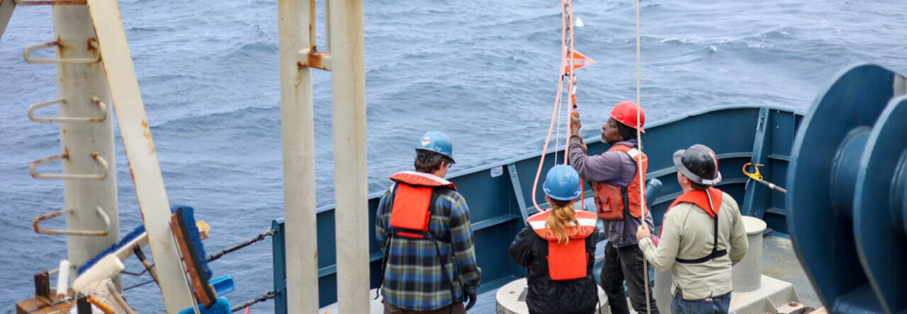
Photo: Ella and Lila observing while shipboard science support group members Cris and Becca prepare for deploying the magnetometer.
Photographer: Jacob Cooper, MATE Intern