Hello all,
Another installment of the story. Still trying to catch up from our internet lull so just stick with me here.
Finally the seafloor mapping has been finished! Don’t get me wrong, the data that was collected was super cool and the map that they are assembling is really amazing but it wasn’t a very interactive process. Once Homeside was in the water we really didn’t need to do anything else. It was towed behind the ship in very specific straight line. We got to the end of one line and the ship turned around and we towed it in another straight line the opposite direction. Not really much to it for 8 days. Finally the scientists confirmed that they had covered the whole area they were trying to map and we could bring the Homeside up. Very exciting moment. Once it was finally up on deck there was a whole new game to play in terms of rearranging equipment. We had to get Homeside tucked away on one side of the large A-frame, bump the multi-corer and box corer forward a few feet to make some extra room, and then pull out the video sledge from the other side of the A-frame to get ready to deploy. Now…these things all seem really straight forward until you consider a few extra details. 1) All of these pieces of equipment are large and weigh hundreds of KILOS (our scientists are German so I figured as a nod to them I would keep my figures metric) which means using cranes, winches, and cables to lift and move things. 2) We are on a moving vessel here. Even on calm days there is still pitch, roll, and heave motion from the swell. Ever seen a large crane in action while it is rocking back and forth? Certainly adds a whole new layer of excitement. 3) There isn’t a whole lot of free space on the deck. This science team brought a bunch of large equipment that is strapped down on the deck. It takes a fair amount of precision to maneuver anything around and so I refer you back to points 1 and 2 to see some of the difficulties that arise. Earlier I gave a strong nod to the technician for being able to do his job very well and save the day. Here and now I have to acknowledge the stellar group of guys working the deck. They are really good at what they do and it is impressive to watch. Their skillful manipulation of the gear and equipment makes even the most complicated transfers go smoothly and safely so hats off to them every single day!
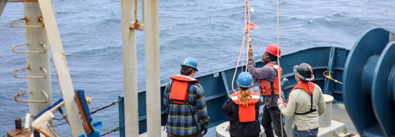
Ok ok I digress. Back to the action. Moving the Homeside out of the way and bringing the video sledge front and center took some time but was eventually accomplished. The video sledge is a rectangular contraption that has several different motion video cameras and one or two still cameras attached to it (See picture below!). The idea is that it will go into the water and sink down over 4000 meters until it gets near the bottom (near…not actually touching down) and then the scientists are able to use the cameras to actually look at the seafloor while we are moving over it. The sledge stays down for 8-10 hours at a time and the scientists monitor and document the video feed looking for the manganese nodules that are the focus of their work right now. It was pretty easy to get into the water and then we just had to wait some more. Personally I really enjoyed invading the lab space and watching the video. The scientists had most of the lights off in the lab and everyone gathered around to see the “action” like it was a show at the theater. The addition of the quotation marks there is because the video itself didn’t actually have a lot of action. Every now and then there would be a fish, brittle star, or little sea cucumber that would make a quick appearance but mostly it was just looking at rocks on the seafloor. But it was looking at rocks on the seafloor over 4 KILOMETERS under the sea that made it special to me…in a nerd sort of way:)
Next installment: the epibenthic sledge and sediment collection. Oooooooooh
Elizabeth
